Spatial Data Collection App (Location-Based Services)
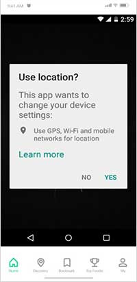
Our Spatial Data Collection App is a powerful mobile application designed to facilitate the collection of spatial data in the field. We specialize in developing rugged and reliable front-end and back-end mobile applications to ensure that our clients can collect data efficiently and effectively in any environment. Our mobile app is designed to work offline and online, enabling users to collect spatial data even in areas with no internet connectivity. One of the key benefits of our mobile app is its ability to collect spatial location data automatically. The app uses GPS technology to capture latitude and longitude coordinates, which are then associated with the collected data. This feature ensures that the spatial data collected is accurate and can be easily integrated into GIS applications.
Another benefit of our mobile app is its ability to work with professional GNSS receivers. This feature ensures that our clients can achieve high-accuracy data collection with a 5M to 10M level of accuracy. The app supports common file formats for input and output, making it easy to import and export data to and from other software applications. Our mobile app also supports real-time data uploading to the server, which enables our clients to monitor and manage the data collection process in real time. This feature ensures that the collected data is secure and can be accessed by authorized personnel at any time.
In summary, our Spatial Data Collection App is a professional and cost-effective mapping and surveying tool designed to enhance productivity while in the field. The app's ability to automatically collect spatial location data, work offline and online, work with professional GNSS receivers, support common file formats, and real-time data uploading to the server provides our clients with a reliable and efficient solution for collecting spatial data.
Some of the benefits of our mobile data collection app;
- • Mobile App for Data collection
- • Automatically spatial location ( Lat, Long) collect
- • Offline / Online
- • Real-time data uploading to server
- • Customized backend
- • Spatial data analysis
- • Real-time data view
- • GIS layers overlaying
- • Statistical Analysis
Use Cases - Environmental conflict mapping through GIS and Historical Event Data Collection and analysis
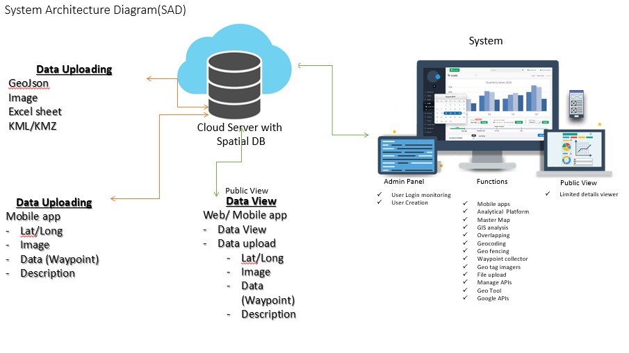
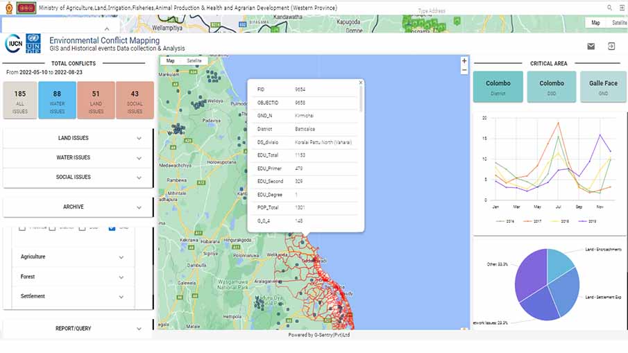
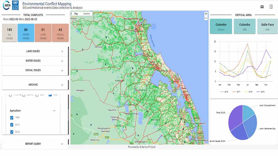
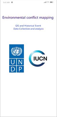
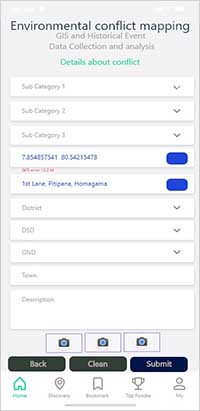
The project titled "Environmental conflict mapping through GIS and Historical Event Data Collection and analysis" is a collaboration between the United Nations Development Programme (UNDP) and the International Union for Conservation of Nature (IUCN). The aim of the project is to develop a Web and Mobile-based WebGIS system that allows for the collection of ground data and display on the WebGIS platform to strengthen environmental conflict mapping through GIS and historical event data collection and analysis. Our team is responsible for developing the mobile application that will be used for data collection, the WebGIS platform for data viewing, and a spatial database. The mobile application will enable users to send data to a cloud server from remote locations. The collected data will be displayed on the WebGIS platform, which allows users to view, analyze, display, and download maps, GIS layers, documents, Excel sheets, and PDFs.
The main objective of this project is to strengthen environmental conflict mapping through the use of GIS and historical event data collection and analysis. The developed system will enable the collection of accurate and reliable data, which will be analyzed on the WebGIS platform to provide insights into environmental conflicts and trends over time. The system is designed to capture data from the mobile application and upload it to the cloud server, which is interconnected with the geodatabase. The data can be uploaded using both mobile and web applications. The WebGIS application is designed to view spatial data and allow the user to do spatial analysis and generate reports.
In summary, our team's contribution to the "Environmental conflict mapping through GIS and Historical Event Data Collection and analysis" project is the development of a mobile application, WebGIS platform, and spatial database. This system will strengthen environmental conflict mapping through the use of GIS and historical event data collection and analysis. The developed system will enable the collection of accurate and reliable data, which will be analyzed on the WebGIS platform to provide insights into environmental conflicts and trends over time.
MOBILE APPLICATION
This mobile app needs to work offline due to poor GSM connectivity in the research areas. The app or device downloads the data from the server and uploads data to the server. If the app works offline, it then stores data in securely locally. This app needs the real-time information, there for it sync data with the Local database and server when it gets connected it is consists of;
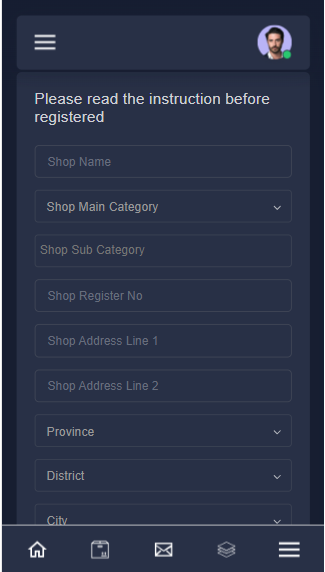
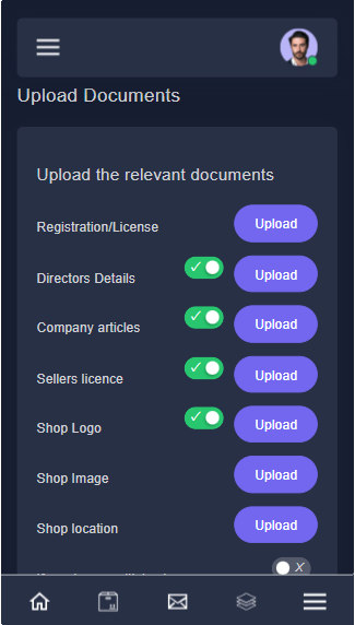
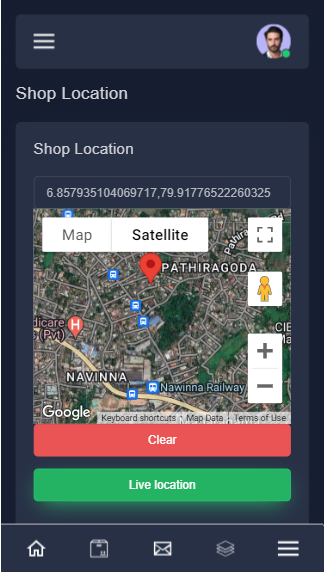
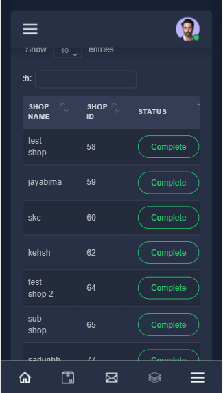
Use Cases - Shop Registration for LAPMC
The Lanka Agri Produce Management Corporation (LAPMC) was established mainly to enhance and ensure food security and sustainable development of the agriculture sector of Sri Lanka through the implementation of efficient and competitive agricultural supply and value chain management systems. LAPMC is interested in having a Mobile base data collection app for Global supermarkets, Retail Shops, Outlets, etc…
Use Cases - PHI Data collection App
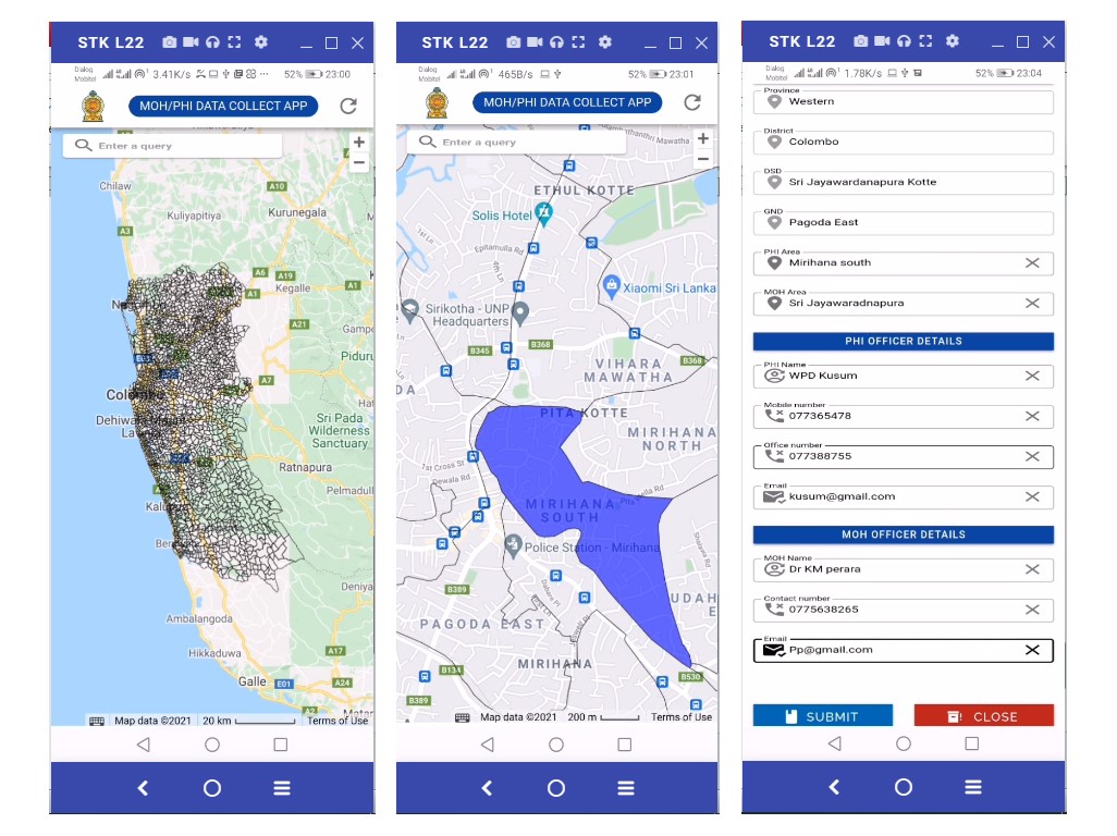
G-Sentry (Pvt) Ltd has developed a mobile application specifically for Public Health Inspectors (PHI) to monitor Dengue patients and breeding locations, and map the PHI and MOH areas. The app provides an easy-to-use platform to track and monitor the spread of dengue in specific areas and help prevent outbreaks. The PHI can easily update and view data on the app, making it a more efficient and effective method of data management. The app is designed to be simple and lightweight, and stores spatial data in a GND layer format. With the app, users can access existing GND map layers directly, and collected data can be accessed in frontend. The app follows a set of easy-to-follow steps to ensure effective data collection and monitoring for public health purposes.
The app also has mapping features that allow for the identification and tracking of dengue breeding locations, which can help prevent the spread of the disease. Overall, this app has helped to improve the management and prevention of dengue in the Western Province of Sri Lanka.
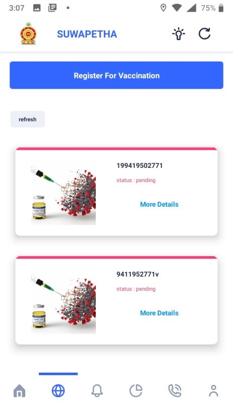
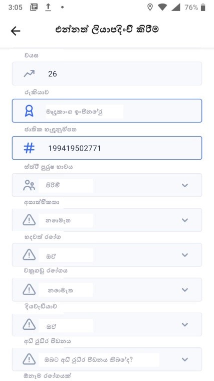
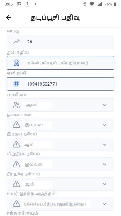
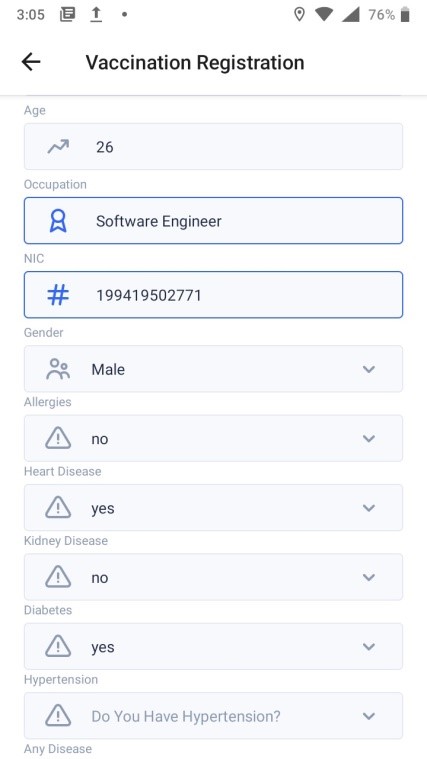
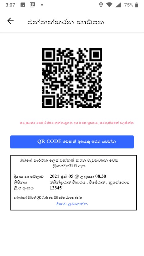
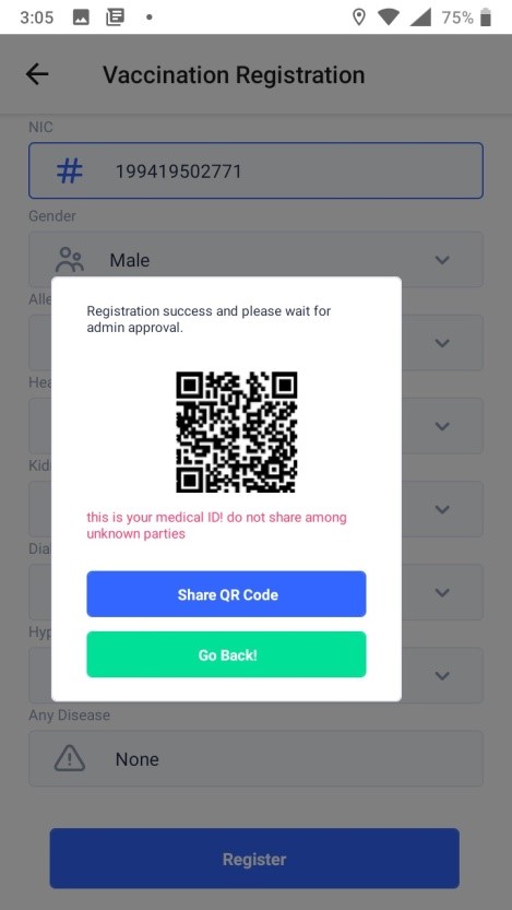
Use Cases - Vaccination Registration for public in COVID-19
The Vaccine Registration Automation system is an innovative solution that simplifies the process of vaccine registration for the public. This system uses a highly secure cloud server deployed at ICTA that allows users to access and update their vaccination information remotely, while staff can access and manipulate the data. The system reduces the fatigue of vaccine registration and avoids long queues, and can be activated within a limited time period through the application. The system is available in Sinhala, Tamil, and English versions, and incorporates web applications for easy access. Additionally, a dashboard is available for monitoring the registration process. This system uses Sri Lanka's first QR code technology for public health.