A Health GIS-based application is a web and mobile GIS (Geographic Information System) platform that allows health professionals to collect, manage, analyze and visualize spatial health data. It enables real-time tracking of health-related events and facilitates informed decision-making for planning and response to health emergencies. The mobile/web health applications are designed to provide users with access to health-related information and enable them to track their personal health data using mobile phones, tablets, or web-based platforms. These applications are particularly useful in communities with limited access to healthcare services, as they provide an additional means of accessing health-related information and services.
The development of these applications includes the creation of statistical and spatial analytical front-end systems with manageable back-ends. The services provided by these applications include a clinic management system, a doctor channeling platform, an epidemic monitoring system, a public awareness application, and a management information system. The clinic management system allows clinics to manage their patient records, appointments, and other related information. The doctor channeling platform allows patients to book appointments with doctors online. The epidemic monitoring system enables health officials to track and monitor outbreaks of infectious diseases. The public awareness application provides health-related information and educational resources to the general public. The management information system helps healthcare organizations to manage their data and make informed decisions.
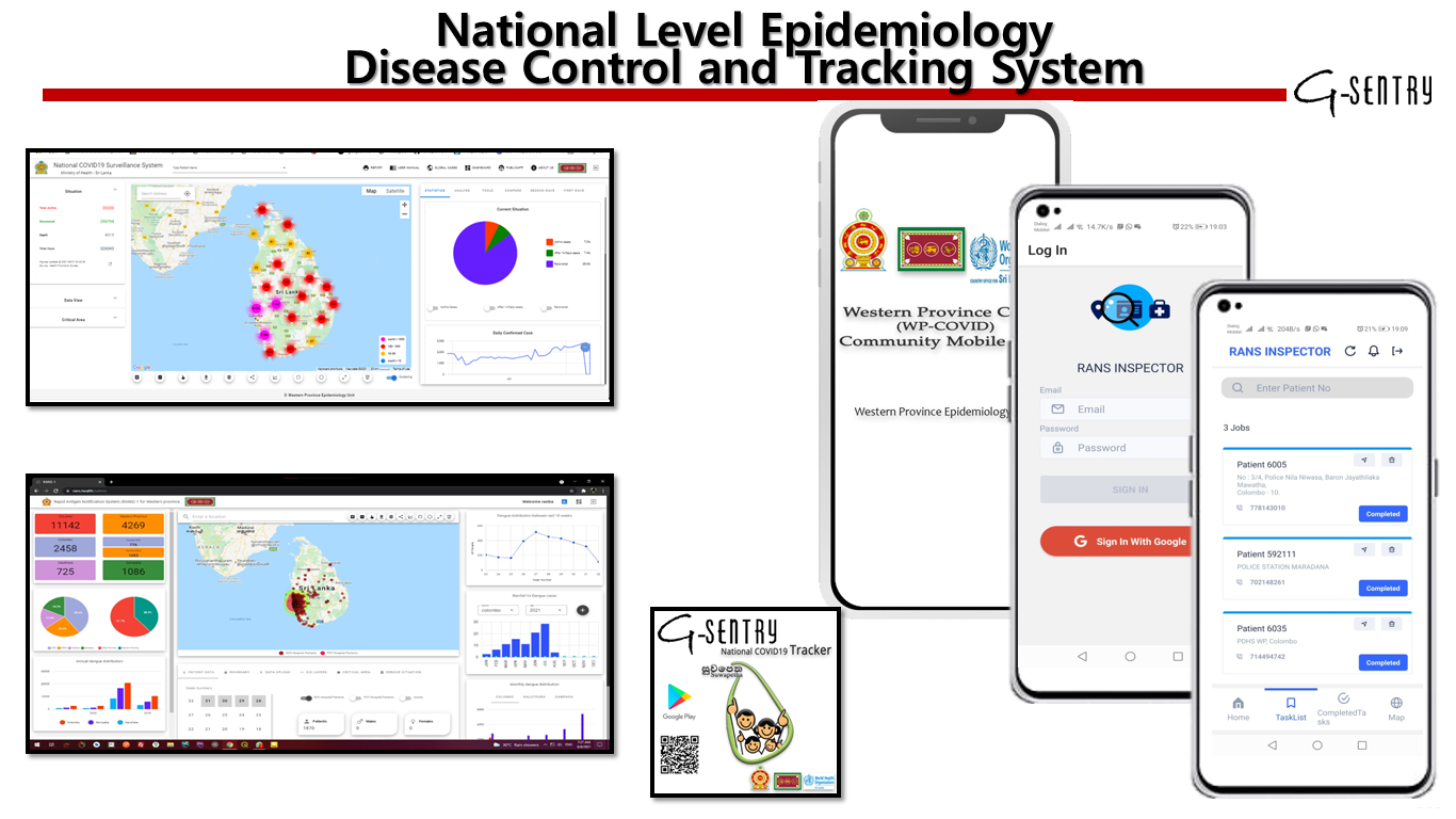
Use Cases – National Covid-19 tracking and surveillance system
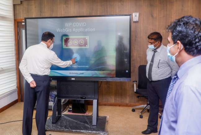
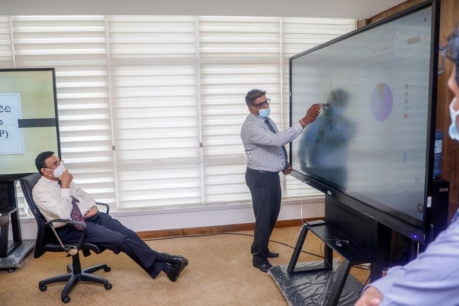
Honorable Governor western province Marshal of the Air Force W. D. M. J. Roshan Goonetileke, RWP, VSV, USP, ndc, psc, has established a monitoring center for Covid-19 in response to the ongoing pandemic situation. The center's main focus is to track the outbreak of the disease and monitor the activities of recovered and quarantined patients. A communicable disease reporting system based on WebGIS and MobileGIS was developed to meet this goal. The system uses a georeferenced GIS database, statistical and spatial analysis, and high-risk area identification to provide a comprehensive view of the pandemic situation. The system also includes features such as a heat map, predictions, and ad-hoc query analysis. By mapping patient data and their connections, the system generates clusters with spatial relationships that can be used to identify risk areas accurately. This application was developed specifically for the Western Province to help combat the spread of Covid-19. This project funded
G-Sentry (Pvt) Ltd developed a National Covid-19 tracking and surveillance system funded by the WHO country office and used by the Western province epidemiology unit. The system was designed to track the outbreak of Covid-19 and monitor the activities of the infected and quarantined patients. It used WebGIS and MobileGIS technologies to provide spatiotemporal data on the patients' locations and movements, their relationships with others, and other relevant information. The system included a heat map, prediction models, and ad-hoc query analysis to help decision-makers tackle the current pandemic. Overall, the National Covid-19 tracking and surveillance system is a crucial tool in the fight against the spread of Covid-19 in Sri Lanka.
Specific Objectives:
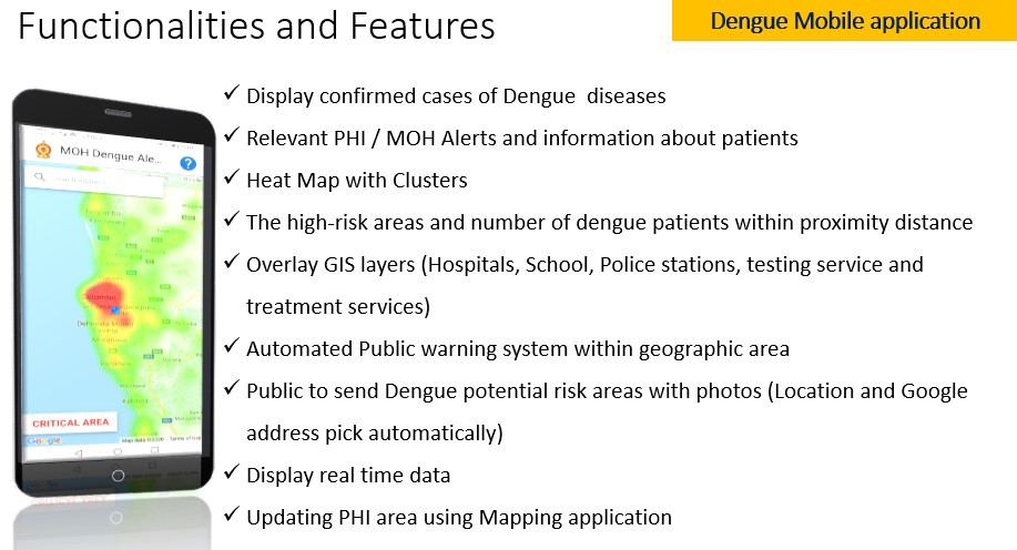
Functionalities and Features:
Use Cases – Suwapatha (COVID 19) Mobile App
Suwapatha app is a mobile application developed by G-Sentry(Pvt) Ltd, in collaboration with the Epidemiology Unit of the Western Provincial Ministry of Health and the WHO country office for Sri Lanka. This application provides the public with free access to information on how COVID-19 spreads and precautionary measures to be taken in public places. It offers detailed guidance to help users overcome the prevailing COVID-19 situation. Suwapatha app aims to provide the right information at the right time to protect users and their loved ones and to stay safe. It provides information such as risk areas, nearby patient count, proximity analysis, alerts, and news. With over 350,000 downloads, the Suwapatha app has become a trending application, ranking number one on Google Leaderboard analytics.
Read MoreGoogle Play store link -https://play.google.com/store/search?q=suwapetha&c=apps
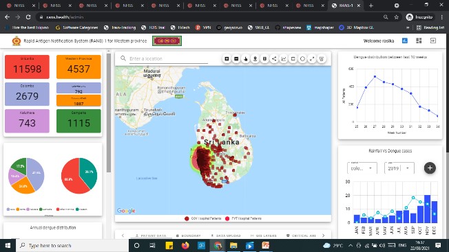
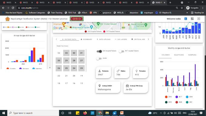
Use Cases – Mobile GIS and Web GIS Application to monitor Dengue surveillance, outbreak prediction, detection and response for Dengue.
G-Sentry (Pvt) Ltd has developed mobile and web GIS applications to monitor dengue surveillance, outbreak prediction, detection, and response. The use of digital vector surveillance systems has become increasingly important in recent years to combat dengue, with traditional methods involving paper-based forms and face-to-face communication being less efficient. The use of maps and GIS technology has allowed public health workers to quickly and efficiently identify areas at greater risk of outbreaks, enabling them to plan vector control strategies and interventions more effectively. G-Sentry's mobile and web applications have been developed in response to a request from the Epidemiology Unit of the Western Province, to provide digital solutions for dengue and other communicable diseases, as well as disaster situations, for both health professionals and the public in the Western Province from 2022-24.
The Epidemiology Unit of the office of the Provincial Director of Health Services in the Western Province lacks a proper surveillance system for common communicable diseases, with the Western Province being the most affected province in relation to seasonal dengue outbreaks. To address this, the Strategic Preparedness and Response Plan for dengue will be implemented in the Western Province, focusing on surveillance, rapid response and case investigation, infection prevention and control, risk communication and community engagement, and maintaining essential health services. The development of web and mobile applications for dengue, other communicable diseases, and disaster situations will be needed, including the review of spatiotemporal characteristics of dengue epidemic, identification of impacts on spatiotemporal distribution, development of a georeferenced GIS database, dengue cluster base tracking system, and a dashboard with statistical and spatial analysis in district level.